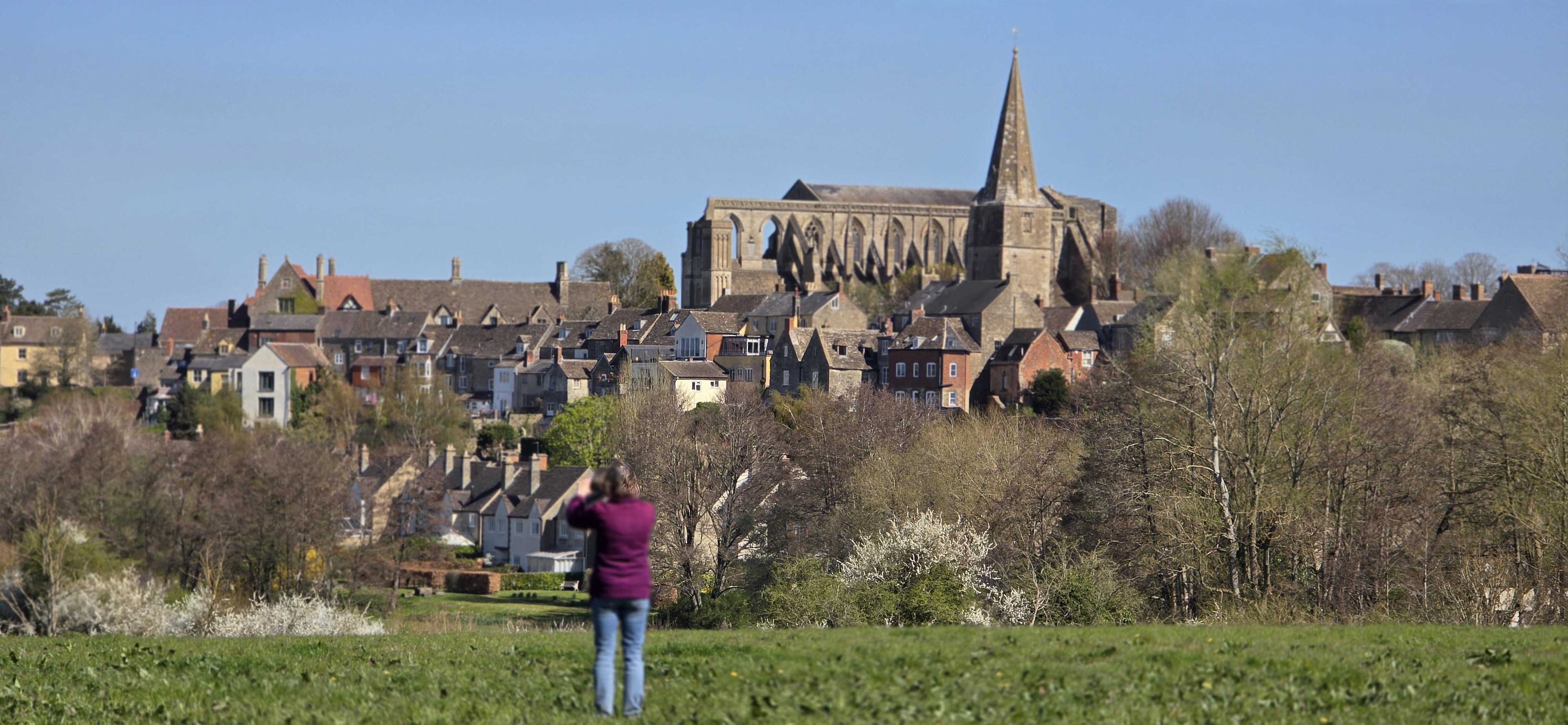
Discover your deanery pilgrimage route

Discover the routes through each of our Deaneries  from our Diocesan Pilgrimage - Kingdom Seeds in Local Soils.

The full routes for the pilgrimage are available below for your personal use. We recommend downloading the OS Map versions which use quiet roads and pathways.

Accessibility

The routes that are most suitable for people with accessibility needs are those that go through urban areas as the rural sections inevitably involve some rough terrain and many stiles. From St Timothy's Liden to Lydiard Tregoz is a particularly good walk for those who need flat terrain or for a powered wheelchair. It leads through urban streets and some extremely beautiful pathways and park land. Please note however that getting to the Bible Society may require a small diversion away from the route as there is a pathway that goes through a gap in the hedge. 

Deanery routes
15th May, day 1 Swindon Deanery - Wanborough to Purton
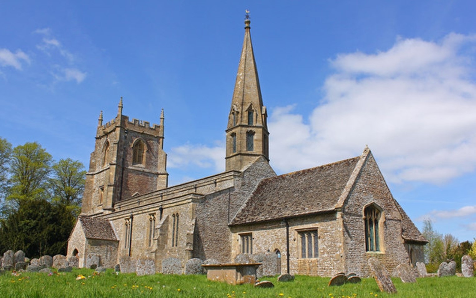
The walk begins at St Andrew’s Church, Wanborough (SN4 0BZ) and ends at St Mary’s Church, Purton (SN5 4EB), passing through the middle of the large town of Swindon, with its designer outlet shopping centre and fading town centre.

The bulk of the day’s walking is on tarmacked paths through the suburbs and centre of Swindon, whilst the beginning and end of the day are on country footpaths.

On route we will visit a number of churches including: St Timothy's, Liden; St John's, Parks; Christ Church, Old Town; St Mark's, Newtown; Pattern Church; St Mary's, Lydiard Tregoz; All Saints, Lydiard Millicent.

Accessibility: This route has some lovely accessible parts particularly from St Timothy's, Liden to Lydiard Tregoz..

Distance: 12 miles

Duration: 5 hours, not including breaks

Level of difficulty: Easy

Maps: Ordnance Survey Explorer 170, 169

Car parking: A car park exists right next to St. Andrew’s Church, Wanborough, although gates locked at night time. Limited on street parking at Purton Church.

Railway station in Swindon centre.  Extensive bus network in Swindon urban area, but limited services to Wanborough and Purton (see www.connectingwiltshire.co.uk/, https://www.swindonbus.co.uk/, https://www.stagecoachbus.com/)

Refreshments:  Cafés and pubs in Swindon, café in Lydiard Park, pubs Lydiard Millicent and Purton.

Toilets: Portaloo at St. Andrew’s, Wanborough,  Christ Church Swindon, Swindon town centre, Designer outlet, Lydiard Park and at Purton Church..

Route Map: There may be some minor changes to the route as the date approaches, but to help you in your planning you can see the expected route with maps and detailed walking instructions here.

View map and instructions here

OS Route available here
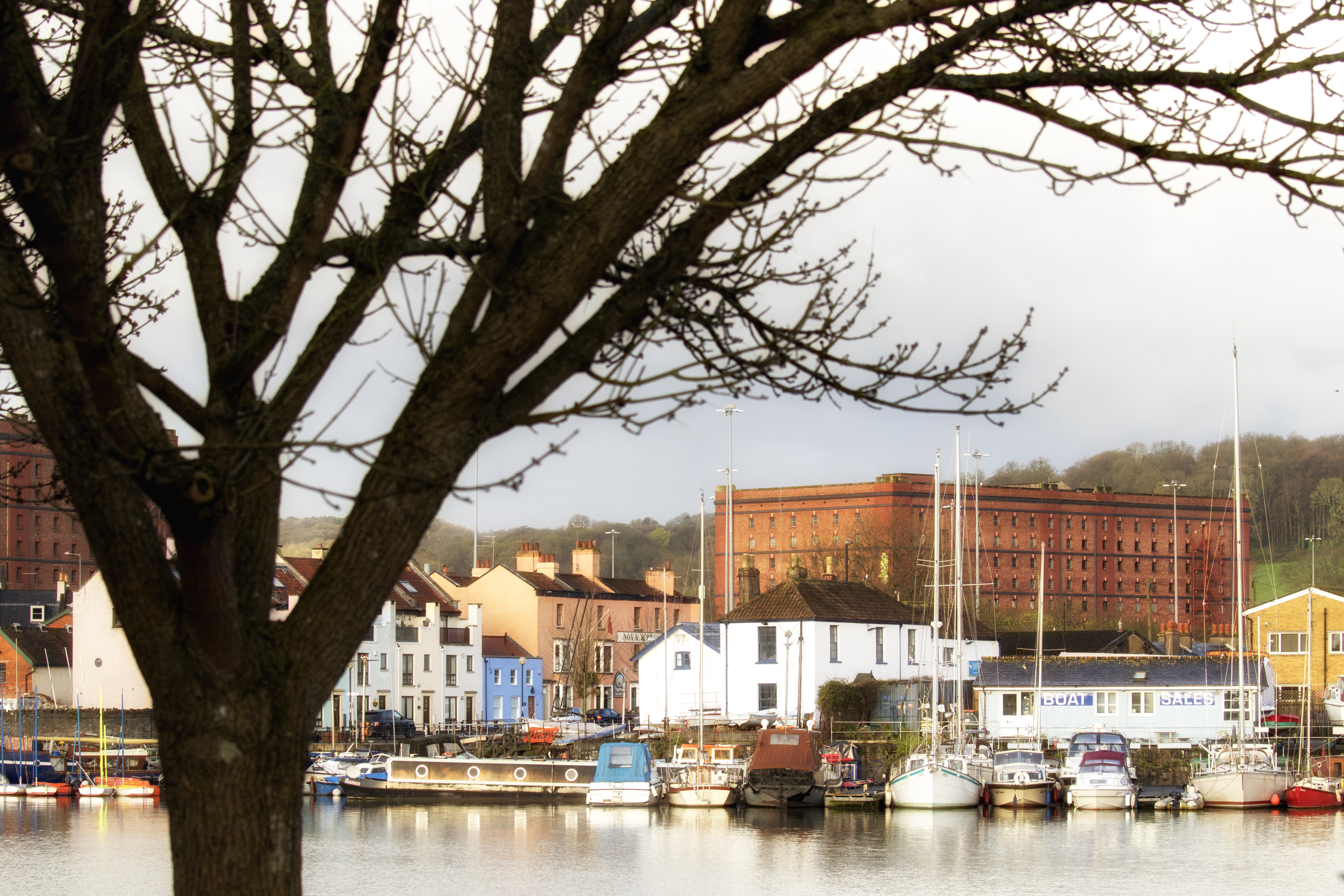


16th May day 2 North Wilts Deanery - Purton to Malmesbury Abbey


The walk begins at St Mary’s Church, Purton (SN5 4EB) and ends at Malmesbury Abbey (SN16 0AA). The first abbey was founded by St Aldhelm in the 7th century, and the current 12th century building is the third abbey to stand on this site.

The first half of the route is along footpaths and bridleways to Ravensroost Wood, which is a good place for a picnic lunch. The second half is mainly on quiet country roads, following the North Wessex Way (the historic route between Oxford and Bristol) through Garsdon and Milbourne, before walking through the historic town of Malmesbury to arrive at the Abbey.

Accessibility: This route requires good mobility as there are lots of paths that are not accessible to wheelchair users.

Distance: 14 miles

Duration: 6 hours, not including breaks (depending on the ground conditions, as the bridleways can be very muddy at certain times of the year)

Level of difficulty: Easy, but long

Maps: Ordnance Survey Explorer 168, 169

Car parking: limited on street parking at Purton Church, long stay parking in Malmesbury at Station Road Car Park (SN16 9QY)

Public transport: see www.connectingwiltshire.co.uk/

Refreshments:  cafés and pubs in Purton and Malmesbury, Malmesbury Abbey café. No amenities along the route, except for some benches in Ravensroost Nature Reserve.

Toilets: Purton Church, Garsdon Church (when open), Malmesbury Abbey, Malmesbury Town Hall.

Suggested websites:

    St Mary’s Church, Purton www.stmaryspurton.org.uk/

    Ravensroost Wood          www.wiltshirewildlife.org/ravensroost

    Garsdon Church              www.woodbridgegroup.co.uk/garsdon/

    North Wessex Way          www.northwessexway.co.uk/

    Malmesbury Abbey           www.malmesburyabbey.com/

Download full route with maps and details instructions

OS Route available here


17th May day 3 North Wilts and Chippenham Deaneries - Malmesbury to Chippenham

Today we start from Malmesbury Abbey and will make our way through the North Wiltshire countryside passing through a number of village parishes and finishing our walk in Chippenham where we will overnight at St Paul's Church. This will be the longest daily section of our route covering 15.3 miles so come prepared.

You can view the route sections using the links below:

Malmesbury to Great Somerford  4.8 miles

Great Somerford to Seagry  1.6 miles

Seagry to Christian Malford  2.3 miles

Christian Malford to Kellaways  2.2 miles

Kellaways to Tytherton Lucas  1.1 miles

Tytherton Lucas to St Andrew's Chippenham  2.5 miles

The final part of the walk will be from St Andrews to St Pauls which is 0.8 miles.

On the way we will pass the churches of St Peter and St Paul, Great Somerford; St Mary the Virgin, Seagry; All Saints, Christian Malford; St Giles, Tytherton Kellaways; St Nicholas, Tytherton Lucas; St Andrew, Chippenham; and St Pauls, Chippenham

Accessibility: This route requires good mobility as there are lots of paths that are not accessible to wheelchair users.

OS Route available here


18th May day 4 Chippenham Deanery - Chippenham to Marshfield

Chippenham to Marshfield Route

The route starts from St Paul's Church in Chippenham and will make its way across Chippenham to the beautiful small church of St Nicholas, Hardenhuish. The walk will then move to St Peter's, Frogwell where we will be invited to share in a school assembly before heading out across the countryside to Biddestone where we will visit our second St Nicholas Church of the day. We will then head for St Margaret's Church, Yatton Keynell where we will be hosted for lunch at our halfway point. After eating we will walk across country to Marshfield passing the closed church of St John's in Ford, and stopping briefly at St James the Great, North Wraxall. 

Accessibility: This route requires good mobility but the section from St Nicholas Hardenhuish to Biddestone is accessible for wheelchair users.

This is one of our longest walks at just over 14 miles.

A detailed map of the walk can be found here:

OS Map of the route


Practical Details

  • Distance: ~22 km (14 miles)

  • Estimated walking time: 6-7 hours at a moderate pace, excluding stops.

  • Start/Finish: St Paul's, Chippenham → St Mary’s, Almondsbury.

  • Terrain: Level suburban footpaths, small rural roads, tracks and pathways.

  • Stops: St Nicholas, Hardenhuish; St Peter, Frogwell; St Nicholas, Biddestone; St Margaret, Yatton Keynell; St James the Great, North Wraxall.

  • Equipment: Comfortable walking shoes, weather-appropriate clothing, small backpack, water, optional prayer or reflection notes.

19th May day 5 Chippenham and Kingswood and South Glos Deaneries - Marshfield to Downend


Day 6 - Marshfield to Downend

We begin at St Mary the Virgin in Marshfield. This Grade I listed church dates largely from the 15th century and stands at the heart of a village with deep historical roots. In July 1643 Royalist troops were billeted here the night before the Battle of Lansdown. Today the church continues active worship and community life, combining heritage with a commitment to environmental responsibility.

Leaving Marshfield, we walk north-west along quiet country roads lined with Cotswold stone walls to the village of West Littleton before crossing the A46 and entering the deer park of Dyrham Park. We descend the hillside to St Peter's Church, parts of which date from the 13th century. The parish is developing it as a pilgrimage destination and encounter.

From Dyrham we continue cross-country, crossing a tributary of the River Frome, and make our way to the village of Pucklechurch. The village was once a Saxon royal estate and is traditionally associated with the death of King Edmund in 946. The church of St Thomas a Becket stands on a site of long-standing Christian worship.

We then descend to the Bristol–Bath cycle path, following the route of the former Midland Railway line past 19th century mining heritage and head towards Mangotsfield.  In Mangotsfield, we will stop at  At St James'.  The churchyard includes Commonwealth War Graves, marking more recent chapters in the area’s history.

Our pilgrimage concludes at the Grade II listed Christ Church, Downend, built in the 19th century as a chapel of ease and now a thriving parish church.

Practical Details

  • Accessibility: This route requires good mobility as there arepaths that are not accessible to wheelchair users. However the sections from Christ Church, Downend to Frenchay Parish Church (has one steep hill) and from Hillside House to St Chad's, Patchway are accessible.

  • Distance: ~14 km (9 miles)

  • Estimated walking time: 4–5 hours at a gentle pace, excluding stops at churches

  • Start/finish: St Mary the Virgin, Marshfield → Christ Church, Downend

  • Terrain: Quiet country lanes, footpaths, a steep hill at Dyrham, and the cycle path section. Suitable for moderate fitness.

  • Stops: St Peter’s Church (Dyrham), St Thomas à Becket Church (Pucklechurch), St James’ Church (Mangotsfield)

  • Refreshments: .

  • Equipment: Comfortable walking shoes, weather-appropriate clothing, small backpack, water, optional prayer or reflection notes.

Access the route on OS Maps

OS map route


20th May day 6 Kingswood and South Glos Deanery - Downend to Almondsbury